
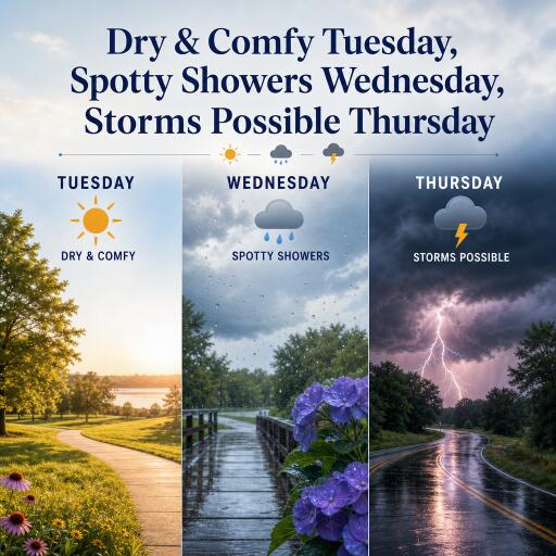

Dry & Comfy Tuesday, Spotty Showers Wednesday, Storms Possible Thursday
A quiet start to the week gives way to a more unsettled pattern as we move toward the end of the week. Here’s the latest forecast for the Susquehanna Valley, with a focus on a comfortable Tuesday, increasing humidity and scattered showers on Wednesday, and a potential for strong thunderstorms on Thursday. A mostly dry weekend is in sight, with a return of shower chances late Sunday into Monday.
Tuesday: Dry and comfortable
Today is shaping up as a gem for outdoor activities and VR-tank battles alike in real life. Temperatures will drift through the upper 70s, with humidity staying pleasantly low. Expect a light, breathable breeze and mostly clear to partly cloudy skies. If you’re planning a long session outdoors, it should feel comfortable and easy to manage. Tonight cools into the mid‑60s, offering a refreshing end to the day.
Wednesday: Humidity rises; spotty showers
Humidity climbs on Wednesday, bringing a more muggy feel. A passing warm front sets the stage for scattered showers and a few thunderstorms, primarily in the afternoon. Highs push toward the lower 80s, with a noticeable uptick in moisture. A few pockets could see brief downpours and minor thunder, so keep a light rain layer handy if you’re stepping out for a late-game meetup or a park stroll.
Thursday: Storms possible
The main event arrives Thursday as a stronger weather system nears from the west. Expect a risk of strong to severe thunderstorms, most likely developing after midday but possibly starting earlier. The primary hazards include damaging wind gusts and hail, plus heavy rain that could trigger localized flash flooding if cells train over the same spots. An approaching front will be the trigger, and some storms may move through in lines or clusters as the day progresses. If you’ll be outdoors, have a plan for shelter and stay tuned for any moment-to-moment updates.
Friday through the weekend: Dry spells and warm temps
Friday morning may see lingering showers, but most of the weekend looks dry and warm. Highs should stay in the lower to mid‑80s, with overnight lows dipping into the 60s. Sunday night into Monday could bring another round of shower chances as the pattern shifts, but the overall weekend should offer pleasant, game-ready weather for outdoor activities and events.
What to watch
Keep an eye on the timing of Thursday’s activity. If you have outdoor plans, a weather-aware approach will help you avoid getting caught in downpours or gusty storms. Bring a light rain layer and a way to monitor updates as the system evolves. Humidity levels will rise on Wednesday, so plan accordingly for a warmer, stickier feel compared with Tuesday. The weekend looks favorable for most activities, with a low risk of rain until late Sunday into Monday.