
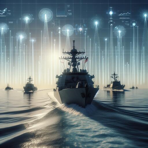

US Naval Vessels Get New Tech Boost for Real-Time Threat Awareness
The U.S. Navy is set to gain a significant upgrade in maritime situational awareness as the Defense Advanced Research Projects Agency (DARPA) taps Raytheon, an RTX business, to develop a next-generation sensing and targeting system. Designed to sharpen threat detection and speed decision-making at sea, the effort blends advanced sensors, intelligent software, and command-and-control tools into a cohesive, real-time picture for operators.
What DARPA and Raytheon Are Building
At the heart of the program is an integrated solution that combines electro-optical/infrared (EO/IR) sensors with detection software and a command-and-control (C2) suite. The system aims to identify, track, and characterize potential threats as they unfold, providing actionable data without overloading crews. By fusing sensor inputs and applying automated detection algorithms, operators can more quickly assess what’s out there and what to do about it.
How the System Works
The concept centers on a tethered drone that carries the sensor payload. Rather than launching directly from a warship, the drone deploys from a semi-autonomous unmanned platform that is towed behind commercial or naval logistics vessels. This approach pushes the sensor vantage point higher and farther from the host ship, extending the field of view and reducing risk to crewed assets.
Through the tether, the drone can maintain a steady data and power link, streaming imagery and target information back to remote operators. That persistent connection supports continuous surveillance and rapid data transfer, helping crews and command centers make informed, timely engagement decisions.
Why It Matters
- Expanded sensor horizon: Elevated EO/IR sensors on a tethered platform can see farther and with greater clarity than deck-mounted systems alone.
- Real-time threat tracking: Automated detection and C2 tools compress the time from observation to decision, improving responsiveness in fast-moving scenarios.
- Lower operational risk: Deploying sensors from an unmanned, towed platform keeps high-value ships and crews farther from potential threats.
- Flexible deployment: Using commercial or logistics vessels as towing platforms supports distributed maritime operations and persistent coverage.
Key Components and Capabilities
- EO/IR sensor payloads that capture multi-spectral imagery for day and night operations.
- Detection and tracking software to flag, classify, and prioritize potential threats.
- Command-and-control tools that integrate sensor feeds into a common operating picture for remote operators.
- Secure communications leveraging the tether for power and data, enabling continuous, high-bandwidth streams.
- Semi-autonomous unmanned platform capable of stable towing and launch-and-recovery under maritime conditions.
Operational Considerations
While the approach offers clear advantages, successful deployment depends on robust engineering and careful integration with fleet operations:
- Environmental resilience: The tethered drone and platform must operate reliably in high winds, heavy seas, and adverse weather.
- Tether management: Ensuring safe handling, power delivery, and consistent data throughput over long durations is critical.
- Electronic protection: The system should be hardened against interference, jamming, and cyber threats.
- Fleet interoperability: Seamless data sharing across ships and command centers is essential for coordinated responses.
- Spectrum and safety: Managing frequencies and airspace around busy sea lanes requires disciplined procedures and compliance.
What’s Next
As development progresses, expect iterative prototyping and at-sea testing to validate endurance, sensor performance, and data integration. The ultimate goal is to give operators an elevated, persistent eye over the maritime domain—one that feeds directly into decision-making workflows. If successful, this approach could enhance threat awareness across a range of missions, from convoy protection to logistics support, amplifying the Navy’s ability to see, sense, and respond in real time.
By pairing a tethered aerial sensor node with a towed, semi-autonomous platform—and fusing the data with advanced detection and C2 software—DARPA and Raytheon aim to deliver a practical, scalable boost to fleet awareness when and where it matters most.