
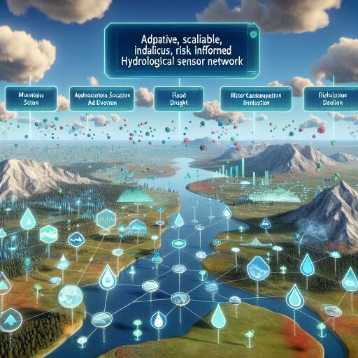

Adaptive, Scalable, Risk-Informed Hydrological Sensor Networks
As climate variability intensifies and water scarcity widens, decisions about where and how we monitor rivers are becoming mission-critical. Streamflow gauges and related hydrological sensors underpin flood forecasting, drought management, reservoir operations, and ecosystem stewardship. Yet many monitoring networks remain a patchwork—built on legacy assumptions and convenience rather than coverage and representativeness—leaving costly blind spots at the very moment we need clarity.
A data-driven reboot for gauge placement
A new framework from researchers Oh and Bartos offers a decisive break from ad hoc design. Their approach uses retrospective hydrological simulations and advanced linear algebra to pinpoint a set of sensor locations that best capture basin-wide streamflow dynamics. Instead of relying on heuristics, this method systematically selects sites for maximum informational value—so managers can reconstruct flows across ungauged or sparsely gauged reaches with far greater accuracy.
The core engine: rank-revealing QR
At the heart of the framework is a rank-revealing QR decomposition, a mathematical technique that isolates the most informative subset of monitoring sites from a large candidate pool. By analyzing 44 years of reanalysis-driven streamflow time series, the algorithm identifies gauges that collectively encode the dominant patterns of variability in space and time. The outcome: a compact, cost-efficient network that preserves predictive skill while minimizing redundancy.
Here’s how it unfolds:
- Hydrological models generate synthetic streamflow across the landscape, mapping responses to weather, terrain, land use, and human impacts.
- The time series feed into the rank-revealing QR decomposition, which selects sites that capture diverse seasonal and regional dynamics.
- The resulting network reconstructs flows at unmonitored locations with improved fidelity, balancing accuracy against operational costs.
Built to upgrade, not upend
Unlike blue-sky redesigns that ignore what’s already in the ground, this framework is retrofit-friendly. It can incrementally enhance existing networks—prioritizing strategic additions, reallocating underperforming gauges, or confirming where current assets already deliver high value. For agencies constrained by budgets, staff, and access, that adaptability is a practical game changer.
Risk-informed, not just data-rich
The methodology goes beyond pure hydrology by factoring in socio-environmental risk: flood hazard zones, vulnerable communities, and infrastructure exposure. This allows managers to weight public safety and emergency response alongside prediction accuracy. In other words, sensor placement becomes a decision-support exercise that aligns with policy goals and on-the-ground operations, not just a statistical optimization.
Proven across diverse climates
From snowmelt-driven headwaters to monsoonal basins, tests show the framework’s robustness and scalability. Because site selection is tuned to regional and seasonal flow regimes, predictive gains hold even under complex hydrological behavior or shifting climate conditions—something conventional, static strategies often struggle to achieve.
Why it matters
Hydrology suffers from a chronic challenge: the “ungauged problem.” Sparse observations hamper model calibration, validation, and forecasting where insights are needed most. By reliably reconstructing flows in data-poor areas, this approach strengthens everything from reservoir scheduling and ecological flow assessments to infrastructure design under uncertain climate futures.
It also sharpens early warning. By emphasizing placements where flood risk is acute, the network becomes a frontline asset for real-time alerts and faster, more targeted responses—translating monitoring budgets directly into societal benefits.
Transparent by design
While many data-driven methods drift into black-box territory, this one remains interpretable. The linear algebra behind the rank-revealing decomposition can be communicated to engineers, planners, and community stakeholders, supporting collaborative decisions and building trust in how and why monitoring resources are deployed.
Beyond rivers: a blueprint for environmental sensing
The same principles can guide sensor networks for soil moisture, groundwater levels, and even air quality. Any domain where measurements are spatially correlated and budgets are finite stands to benefit from a rank-revealing, information-maximizing strategy.
What’s next: real-time adaptation
The future lies in coupling this framework with live data streams and adaptive reconfiguration. As climate patterns shift, land use changes, or infrastructure evolves, networks could update in near-real time to maintain optimal coverage and skill. That vision dovetails with the rise of smart water systems—high-frequency sensors, cloud-native analytics, and AI-driven operations.
The bottom line
Oh and Bartos have delivered a blueprint for sensor networks that is scientifically rigorous, operationally pragmatic, and socially attuned. By blending decades of hydrologic simulations with rank-revealing math and risk-aware priorities, their approach sets a new standard for monitoring design—one that meets the moment for water security in a warming world.